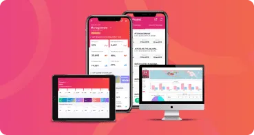
In the context of the Coordinating Minister for Maritime Affairs and Investment’s monitoring of the development of five Super Priority Tourism Destinations (DPSP). The Coordinating Minister for Maritime Affairs and Investment (Menko Marvel), Luhut Binsar Panjaitan, trusted TOMPS, a digital application owned by PT Telkom Indonesia (Persero), to launch a Geographic Information System (GIS)-based monitoring system.
This system combines information from each DPSP, with the five tourism areas included in this project being Lake Toba, Borobudur, Lombok, Labuan Bajo, and Manado-Bitung-Likupang. TOMPS is an application that provides development information such as total budget, project category, physical realization, constraints, and the most recent photos from the field in this case.
The Coordinating Minister for Maritime Affairs and Investment, Luhut Binsar Pandjaitan, directed the acceleration of the DPSP project in August last year during the Coordination Meeting of the 5 DPSP Steering Committees, so that there would be data updating or updating that can be done periodically so that it is by what is in the field. Not for nothing will this project be prepared as part of a series of international events at the G20 Summit in November.
As a result, Kemenkomarves and PT. Telkom Indonesia continues to optimize TOMPS, particularly in data updates and dashboard monitoring that includes critical information.
Kosmas Harefa, Assistant Deputy for Sustainable Tourism Development at the Ministry of Maritime Affairs and Fisheries, stated that using Tomps was extremely beneficial in the role of monitoring development, particularly at the high level. This was done so that the leaders could monitor the DPSP’s development, thereby speeding up the decision-making process.
“By the Minister of Maritime Affairs and Fisheries’ recommendation regarding the acceleration of the 5 DPSP projects, we as one of the users also update the data, which is entered by the PIC of each regional authority, although we continue to control monitoring.” “When high-level leaders see Tomps, they can get up-to-date information about the situation on the ground,” he said last Wednesday at the Business Insight event in Jakarta.
According to Arif Fajaruddin, CEO of TOMPS, the TOMPS application is an integrated system that contains development information such as total budget absorption, project categories, physical realization, constraints, and the most recent project status in the field accompanied by real-time evidence, ensuring that there are no issues that frequently arise in the field.
“These five regions had systems that were not yet integrated.” So issues frequently arise in the field, until there are the term 101 issues, in which the problems that frequently arise appear to be undetected. As a result, we established a single data gate to ensure that all field progress in these five DPSPs is integrated and monitored,” he explained.
The inauguration of the 5 DPSP projects is part of the government’s “10 New Bali” program, which aims not only to attract tourists but also to improve the domestic creative economy ecosystem.
TOMPS, as an application containing this information, has provided training on how to use the TOMPS application to the relevant Authority Body in each region, in this case, the Borobudur Authority Agency. Later, TOMPS will continue to train authority bodies in each region on how to use the TOMPS application, to accelerate the role of supervising the development of these five DPSPs.


